
This is the final stage of the CPO export route. The atlas separates regional palm sourcing corridors from verified liquid-bulk export gateways and shows where the marine export chain connects to nominated ports and terminals. Port markers are positioned on the named gateway locations, while corridor markers show sourcing geography rather than a single site. The map is a commercial logistics reference and does not imply ownership or guaranteed terminal access.
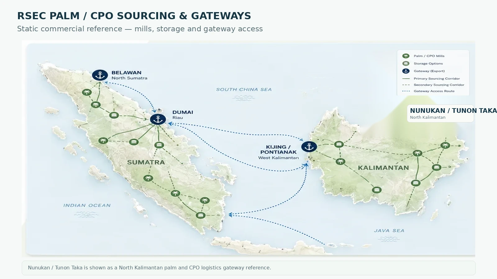
Green gateway pins show named ports / terminals. Dark-green pins show regional palm sourcing corridors. White pins show city or logistics references. Regional corridor markers indicate geography only and are not intended to pinpoint an individual mill or estate.
These are market, sourcing and logistics reference points. Inclusion does not represent RSEC ownership, exclusivity, appointment or guaranteed access to third-party infrastructure.